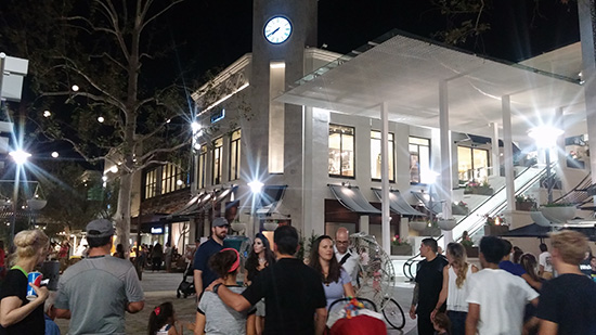
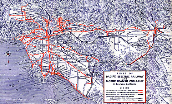
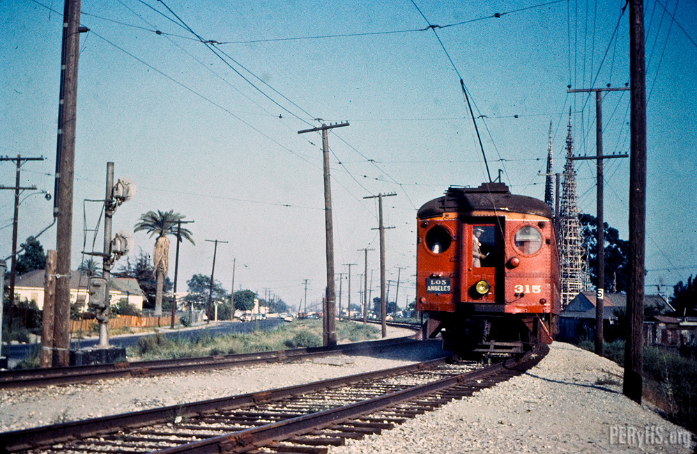
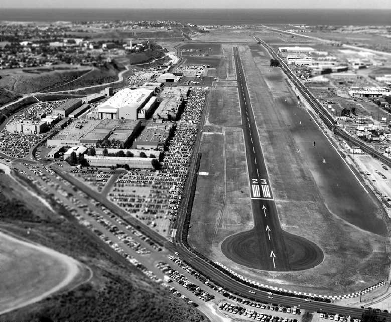
Yes, friends, it's an exciting week for Los Angeles. Dodger baseball season returns to
The Stadium on Friday, and this Sunday,
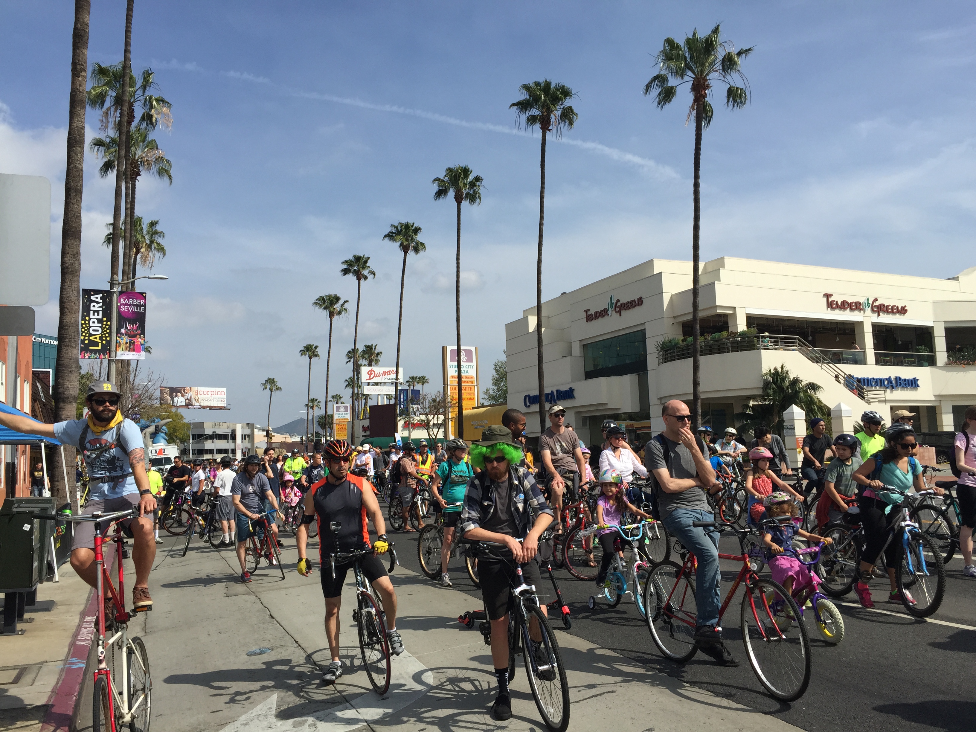
CicLAvia season begins!
This time, the route returns to
IronicIconic Wilshire Boulevard, a route first used in June of last year. The Militant
already wrote one of this legendary Epic Militant CicLAvia Tour posts for
that one, but he felt it was time for a minor update.
So after much more Militant research, he adds
six additional points of interest to the tour, and even slightly updates some of the other points as well.
You know you totally want to eat this up, so here it is, Los Angeles!
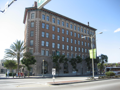
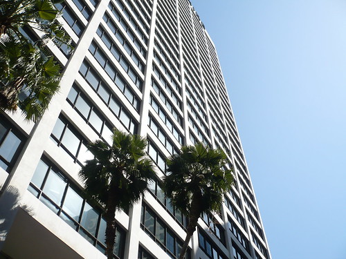
1. One Wilshire Building/Wilshire Bookend Palm Trees1966
624 S. Grand Ave, Downtown
Built during the first wave of modern skyscrapers following the repeal of Los Angeles' building height limit laws, this building, designed by architectural rockstars
Skidmore, Owings and Merrill (who also went on to craft Chicago's Sears Tower, among many others) stood for most of its life as the address of legal and financial institutions. After a renovation in 1992, this building is now the location of
CoreSite, a major data colocation center, which carries the primary Internet connections for Los Angeles (without this building,
you can't read this!)
Take note of the row of palm trees, planted here in the 1970s: They are meant to evoke the end of Wilshire Boulevard, as on the opposite end, at Santa Monica's Ocean Avenue, 16 miles from here, you will also find a row of palm trees.
2. Wilshire Grand Center2017
Wilshire and Figueroa (SW corner), Downtown
This big-ass hole in the ground used to be the Wilshire Grand Hotel, formerly (in reverse chronological order) the Omni Hotel, Los Angeles Hilton, Statler Hilton and Statler Hotel.
On this site will rise the new
Wilshire Grand Center, Los Angeles' (and the West's -- suck on it,
Transbay Tower SF!) tallest building at 73 stories and 1,100 feet (kinda sorta, there's a spire, you see...). It will also be Los Angeles' only modern skyscraper without a flat roof. It will house
Wilshire Grand Hotel 2.0 and a bunch of shops and condos.
The building will also have a "sky lobby" up at the top and will be the first skyscraper anywhere to sport a mohawk.
The current construction site is the location of "The Big Pour" - which lasted from February 15 -16, where 21,200 cubic yards (81 million pounds) of concrete were continuously poured - earning it
a Guinness World Record for that feat.
3. L.A. Prime Matter Sculpture1991
Wilshire and Figueroa (NW corner), Downtown
Wilshire is full of awesome-looking public art. Here's one relatively-recent sculpture right at the northwest corner of Wilshire and Figueroa. Designed by the late Venice-based artist
Eric Orr, who had a penchant for utilizing elemental themes in his art,
L.A. Prime Matter features twin 32-foot bronze columns that feature water sliding down its faces, and during random moments, FIRE emanates from the middle channels of the columns! The effect is total bad-ass, and its bad-assnes is magnified at night.
Hopefully participants in a bad-ass event like CicLAvia would get an opportunity to see the pyrotechnics!
4. Urban Chew (April Fools!)2013
North side of Wilshire Bridge over 110 Fwy
The Militant just discovered this peculiar public art installation by artist Matthew Kasmirofsky while witnessing the Big Pour. About 160 pieces of gum, made of either actual gum pieces or latex rubber, were placed here in an art piece described by the artist as "a commentary on contemporary consumerist culture," especially how things are easily and carelessly discarded after a short time. Kasmirofsky has done similar public art installations in Chicago, Pittsburgh, Montreal and Stockholm.
5. Site of George Shatto Residence/Good Samaritan Hospital1891
Wilshire Blvd and Lucas Ave, Downtown
Before it was named Wilshire Boulevard, it was once called Orange Street, and on the corner of Orange and Lucas was a Queen Anne-style mansion belonging to George Shatto, a real estate developer who first developed Catalina Island and the city of Avalon. If you read the
Epic CicLAvia Tour 4.0 post, his name is brought up as one of the famous Angelenos buried (in a rather ornate pyramid) at Angelus Rosedale Cemetery.
But check this out! Take a look at the picture above, and pay close attention to the masonry wall going uphill that fronts Lucas Avenue. Now, on CicLAvia Sunday, look at the exact same spot, on the northwest corner of the intersection. The house is gone, but the original wall
still remains!
Good Samaritan Hospital, which was founded in 1885 and moved to the current site in 1911, is also the birthplace of many native Angelenos, including mayor
Eric Garcetti.
6. Site Of "Redbeard" Pirate Lynching (April Fools!)1879
1675 Wilshire Blvd, Westlake
In 1878 a man known as Cochran "Redbeard" O'Connor, a self-described "pirate," sailed into San Pedro Harbor and arrived into Los Angeles via railroad. He went on a notorious public rampage described, by the old
Los Angeles Herald as, "Six months of public drunkenness, vulgarity, and lewd and lascivious behavior, which cannot be fully described in the pages of this publication." Other historical accounts of O'Connor purport he engaged in public displays of urination, indecent exposure, masturbation and groping. Police attempted to arrest him several times, but he somehow eluded them. Finally, on March 27, 1879, he was found attempting to defecate on the front yard of a mansion on Orange Street, when an angry mob chased him down. He was hung by a sycamore tree that stood near where the Home Depot stands today. According to a later
Los Angeles Herald article, His boat in San Pedro Harbor was burned and sunken. O'Connor was buried in an unmarked grave at Evergreen Cemetery.
7. Los Angeles Teachers (a.k.a. 'Stand And Deliver') Mural1997
Wilshire and Alvarado, Westlake
Art imitates life imitating art imitating life in
this mural by popular Salvadoreño American muralist
Hector Ponce depicting actor Edward James Olmos, who portrayed Garfield High School math teacher Jaime Escalante in the 1988 movie
Stand and Deliver, standing next to the real-life Escalante, and delivering a mural that's part-Hollywood, part-Los Angeles, part-Latino pride, part Eastside pride and if the Internet were as accessible back in 1988 as it is today, would make one epic photo meme. And it's painted behind the 1926
Westlake Theatre, which is slated for renovation into a community-baed performance arts venue sometime soon. Celebrate the 25th anniversary of
Stand and Deliver by having the
ganas to stop by.
8. Gen. Harrison Gray Otis Statue1920
Wilshire Blvd and Park View Ave, MacArthur Park
Gen. Otis is perhaps the most visible statue at the park, which predates MacArthur's WWII service. This general served in the Spanish-American and Philippine-American wars, and also fought as a Union soldier in the Civil War. But in Los Angeles, he is most known for being the founder, owner and publisher of the Los Angeles Times. So why is he here? His Wilshire Blvd mansion, called The Bivouac, was located across the street, was later donated to Los Angeles County and became the original campus of
Otis Art Institute. It's thought that his statue is pointing to the site of the Elks Lodge, but he's probably just pointing to his old house.
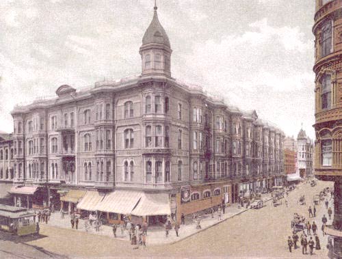
9. Bryson Apartment Building1913
2701 Wilshire Blvd, MacArthur Park
This 10-story Beaux Arts apartment building, built 100 years ago, was the 20th century precursor to today's fancy modern 21-century high-rise residential developments. Built by developer Hugh W. Bryson, it was built in a part of Los Angeles that was known at the time as "the west side" (let's not open that can of worms right now, okay?). It was one of Los Angeles' most luxurious apartment buildings, and had a large neon sign at the roof (characteristic of these kinds of developments back then). Several Raymond Chandler books reference The Bryson. The 110,000 square-foot building is also part of the National Register of Historic Places and a Los Angeles Historic-Cultural Monument.
10. LaFayette Park1899
Wilshire Blvd and LaFayette Park Place, LaFayette Park
Clara Shatto, the widow of George Shatto (remember him?) donated 35 acres of her land to the City of Los Angeles in 1899, which was once oil wells and tar pits. Her late husband wanted it turned into a city park, and so it became Sunset Park, which existed for 19 years before the locals wanted it renamed to honor the 18th-century Frenchman who was a hero in both the American and French revolutions. Gotta give LaFayette park some props for living so long in the shadow of its more famous neighbor, MacArthur (Westlake) Park.
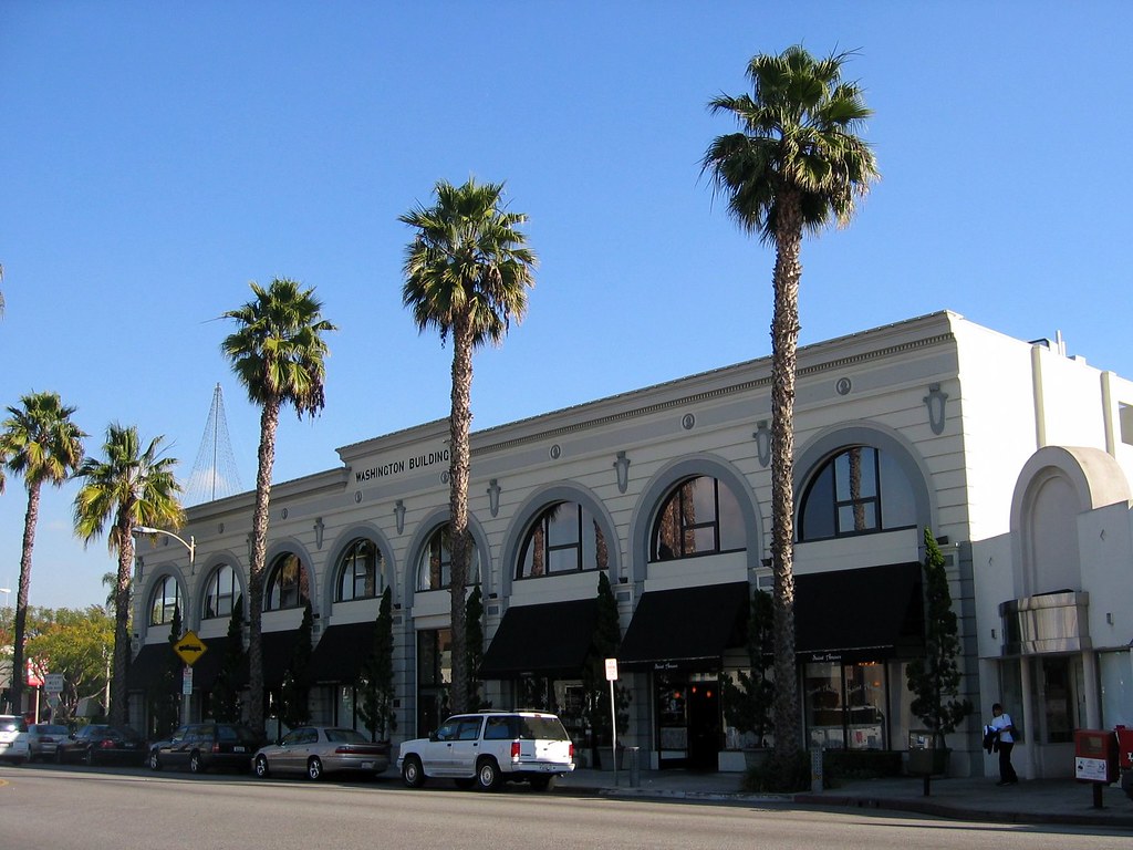
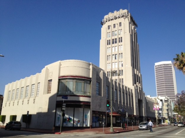
11. Bullocks Wilshire/Southwestern Law School1929
3050 Wilshire Blvd
Perhaps one of the most iconic examples of Art-Deco architecture in Los Angeles, this former Bullocks Department Store was designed with a tower to resemble a New York-style skyscraper in then-unabashedly low-rise Los Angeles. It was the epitome of shopping in style in its heyday, with its own rear parking lot and other auto-centric amenities. It ultimately fell victim to the 1992 Los Angeles Riots and was closed down the next year. In 1994, the nearby
Southwestern School of Law bought the building and incorporated it into its campus, restoring much of the Roaring 1920s Art Deco aesthetics.
12. Shatto Placec. 1880s
Wilshire Blvd and Shatto Pl, Koreatown
Gee, we can't get seem to get away from that George Shatto guy, can we? George and Clara owned a plot of land here on this street, which was once home to some of the most beautiful mansions in Los Angeles at the time. Although Clara sold the land in 1904, George stipulated that all properties on the street maintain the character of the exquisite homes there, which was challenged several times until the late 1920s, when the homes started to be demolished in favor of more modern commercial development.
13. Brotherhood Mansion Site (April Fools!)1898
3183 Wilshire Blvd, Koreatown
The first automobile in Los Angeles
took to the streets in 1897 and Delbert J. Walford, businessman and early automobile enthusiast, (and one of the first Angelenos to own a car), created the Most Benevolent Brotherhood of the Horseless Carriage (a.k.a. "The Brotherhood"), perhaps Los Angeles' first-ever car club. Members would offer repairs to stranded motorists, free of charge, hold Saturday afternoon salons to educate the public about the automobile, and offer driving classes for a very small fee. Some though, considered the organization to be a cult-like group, where members lived inside the mansion, maintaining strict standards on uniform dress and hats. In 1903, the group published a 106-page, eerily prophetic utopian (
autopian?) manifesto,
The Automobile For A Most Glorious California, envisioning a network of "automobile super-roadways" spanning several lanes wide, the creation of "automobile gardens" built around cities and communities oriented towards the car, developed far from the urban core. They also shunned and criticized the use of streetcars, bicycles and long-distance pedestrian travel. Now here comes the strange part: In August 1909,
Walford and all of the members who were have known to have lived in the mansion vanished without a trace, leaving all material valuables (aside from their automobiles) behind. Their whereabouts were never found and the mansion was razed in 1917. Ironically, the site is now the location of the Wilshire/Vermont Metro station.
14. "The Vermont" Highrise Apartment Development
2014
Wilshire Blvd and Vermont Ave., Koreatown
What's with the construction? It's a 30- and 25- story highrise mixed-use apartment development called "The Vermont" by
J.H. Snyder Co. which is slated to open sometime this year. It's Metro-accessible, but who the hell can afford the rents for this place?
15. Consulate RowVarious locations along Wilshire Blvd between Vermont and Crenshaw
Some 62 countries have consular offices in the Los Angeles area and 41 of them have addresses on Wilshire Boulevard. Proximity to various foreign financial institutions on Wilshire, as well as nearby Hancock Park, where many consul-generals have traditionally resided, are the main reasons for such a high concentration of consulates on this stretch of Wilshire. The consulate offices for Bangladesh, Bolivia, El Salvador, Ethiopia, Guatemala, Honduras, Indonesia, South Korea, Nicaragua, Peru, The Philippines, Sri Lanka and Taiwan are all located on Wilshire between Vermont and Crenshaw. Many of them display their national flags in front of their respective office buildings. How many can you spot during CicLAvia?
16. Gaylord Apartments1924
3355 Wilshire Blvd
Though the building's prominent neon sign has been source of many a snicker by immature junior high school kids, this building represents some serious history. It was named after Wilshire Boulevard's namesake, Henry Gaylord Wilshire, who was known as a wealthy real estate developer and outspoken socialist (Does that make sense?), who donated a 35-acre strip of barley fields to the City of Los Angeles on the condition that it would be free from railroads or trucking.
The building itself is a 13-story Italian Renaissance-style apartment building that actor John Barrymore (a.k.a. Drew's grandpa) and then-presidential candidate Richard Nixon once called home.
17. Brown Derby Site1926
3427 and 3377 Wilshire Blvd
The now-defunct "The Brown Derby" local chain of restaurants were synonymous with Hollywood glitz and glamour. The Wilshire Boulevard location was the first of four (the others were in Hollywood, Beverly Hills and Los Feliz). In close proximity to The Ambassador Hotel and its Cocoanut Grove swing/jazz club, this was the original hipster joint back in the day, only back then the hipsters were actually cool and looked good. In 1937 the building was moved across the street and closed in 1975. In 1980, a shopping center was built on the site and the iconic dome structure was incorporated into the shopping center that exists today. It's situated on the third floor, above The Boiling Crab seafood restaurant. It's something to ponder on while you wait 90 minutes for your table.
Note that the pictures for #13 and #14 connect vertically - that's the Gaylord Apartments behind the Brown Derby!
18. Robert F. Kennedy Inspiration Park/Ambassador Hotel Site2010
Wilshire Blvd between Catalina Street and Mariposa Avenue
The Militant
wrote a post in 2010 about this unique public space dedicated to Sen. Robert F. Kennedy, who was assassinated just yards away at the Ambassador Hotel, which was demolished in 2005 and where the LAUSD's sprawling and costly RFK Community Schools campus now stands. There's Kennedy quotes on public art installations and benches for you to chill on. There's also speakers playing recordings of some of the jazz music that was performed at the hotel's famed Cocoanut Grove swing and jazz club.
On April 18-19, the school campus will host the first-ever
K-Town Night Market with food, vendors and live entertainment.
19. Site of DeBeers Paradise Flower Garden (April Fools!)1897
Wilshire Blvd and Normandie Avenue, Koreatown
Everyone knows that The Bird of Paradise is Los Angeles' official flower, but how did it become so popular? South African trade importer and horticulturist Wouter DeBeers, who built the DeBeers mansion and gardens in Garvanza, bought a plot of land on Wilshire Boulevard at Normandie Avenue in 1896 in hope of building a second home closer to the city. Having discovered he lacked the funds for constriction, and not wanting his land to remain vacant, imported several Bird of Paradise plants from his native Durban and grew an exotic plant garden on the plot, called "Paradise Flower Garden." Visitors were amazed at the orange bird-like flowers that seemed to flourish with little watering. DeBeers later sold seedlings and eventually became profitable enough to finance construction of his mansion, which he eventually built in 1905. The residence and legendary garden were eventually razed in 1919. The popularity of the flower in Los Angeles was largely credited to DeBeers.
![]()
1931
Wilshire Blvd and Western Avenue (duh...), Koreatown
The 12-story structure, designed by Stiles O. Clements, is Los Angeles' emerald-green temple to all that is Art Deco. Originally operating as the "Warner Theatre" (Specifically the Western Avenue location of Warner Bros. chain of movie theaters; The Warner Theatre in San Pedro is another example), The Wiltern (named so since 1935) has seen many cycles of decay and rebirth, most recently in the 1980s, when preservationists renovated the theatre to a performing arts venue. The contemporary Wiltern Theatre has been operating since 1985.
21. The Last House On Wilshire1918
4016 Wilshire Blvd, Hancock Park
Wilshire Boulevard was once a prestigious address for many a prominent Angeleno, from General Otis to, yep, George Shatto (don't worry, this is probably the last Shatto reference in this post). But after the 1920s, Wilshire became undeniably commercial and even the most dignified free-standing household succumbed to the wrecking ball.
Except
this one, standing (quite nicely) on 4016 Wilshire, just yards west of Wilton Place. Built in 1918, this six bedroom, three bathroom, 3300 square-foot single-family home is literally
the last of its kind on Wilshire. The earliest recorded owner, John and Katherine Neeland (circa 1921), of Canada, sold it in 1925 to Elmer & Clara Neville. The Neville family trust still owns the house to this day. If you owned the last house on the street, you'd hang on to it, right?
22. Crenshaw Tar Pits (April Fools!)Discovered 1902
Wilshire and Crenshaw boulevards, Hancock Park
Everyone knows about the world-famous tar pits of La Brea just down the street, but did you know there's a (much smaller) tar deposit by Wilshire and Crenshaw? Look around towards the back end of the parking lot on the southwest corner and you'll find less than a dozen tar puddles and seeps peeking through the pavement.
23. Rimpau Blvd/Rancho Las Cienegas1823-1920s
South of Wilshire Blvd between Norton Avenue and La Cienega Boulevard, Hancock Park
You may or may not notice that all of the streets south of Wilshire from Norton Avenue to just past the Fairfax Avenue terminus of the CicLAvia route run in a diagonal fashion, akin to the way Downtown Los Angeles streets run. Why? This was once part of the old Rancho Las Cienegas Spanish land grant, which was given in 1823 to Francisco Avila, once mayor of Spanish-era Los Angeles. In 1866, the land was divided among his four children, one of whom was his daughter Francisca, who married a German dude named Theodore Rimpau...Does that name sound familiar? Yep, it's the namesake of Rimpau Blvd. The last remaining rancho land was eventually sold and subdivided by Theodore and Francisca's sons in the 1920s.
24. E. Clem Wilson Building (aka Samsung Building)1929
Wilshire Blvd and La Brea Ave, Miracle Mile
At 191 feet, it was once the tallest commercial building in Los Angeles (honoring the height-limit restrictions at the time). Built during the first wave of commercial migration from Downtown Los Angeles, this structure originally housed legal and medical offices belonging to Jewish professionals, and was part of the genesis of the Jewish community in this area (centered on Fairfax Avenue). The building once featured a large mast on top to serve dirigible blimps(!) but is most famous for the massive 4-sided neon advertisements installed on the crown in the 1960s: First, Mutual of Omaha Life Insurance, then Asahi Beer and now Samsung Electronics.
25. The Los Angeles "Hair District"c. 1970s
Wilshire Blvd between Cloverdale and Burnside avenues.
The Militant wrote about
this interesting little business corridor five years ago, noting an unusually high concentration of wig, weave and human hair retailers along this part of Wilshire.
26. The Desmond's Department Store Building1928
5500 Wilshire Blvd
This is the building that started it all, the archetype that led to many miracles on this mile of Wilshire Boulevard. The Wilshire location of Desmond's Department Store was the first high-end department store on Wilshire, and the retail development anywhere to sport a rear parking lot, and a main entrance that faced the back, rather than the street, as well as large circular display windows to attract motorists.
The 10-story building
will soon be adaptively-reused into 175 (luxury, The Militant can assume...) apartments which will open sometime next year.
27. A.W. Ross Monument1956
5700 Wilshire Blvd (Wilshire Blvd and Curson Ave)
"A. W. Ross, founder and developer of the Miracle Mile. Vision to see, wisdom to know, courage to do."
The story goes: Real estate developer A.W. Ross bought an 18-acre stretch of property along Wilshire Blvd in 1921 for $54,000 and in less than a decade's time, turned that stretch of dirt road, oil fields and farmland into Los Angeles' bougiest stretch of retail, which boomed -- of all times -- during The Great Depression. You can call that a miracle.
Ross was considered an innovator in his day; he brought large-scale, ritzy retail developments to his district, all with rear parking lots, and all made to be visible at 30 miles per hour. Left-turn lanes and synchronized traffic signals were credited to Ross. Streamline Moderne and Art Deco architecture flourished thanks to Ross' development.
In 1956, this bronze bust was placed on this landscaped traffic island to honor the man who brought the "town" out of Downtown and stretched it out like Laffy Taffy.
But little else is known about A.W. Ross (no, he was not affiliated with the
Ross Dress For Less stores). Where did he come from? What was his real estate dealings before the his purchase of Wilshire? What did "A.W." stand for, anyway?
28. Some Hairy Elephants In Some Oily Lake16,000 B.C.
5801 Wilshire Blvd, Miracle Mile
You may or may not know about
this place, built in 1976, and if you don't, there's really no hope for you.
George Allan Hancock, who owned the Rancho La Brea Oil Company, donated a large plot of land to the
Los Angeles County Museum of History, Science and Art, who dug the area for Ice Age-era fossils. In 1965, the "Art" part of the LACMHSA (pronounced,
"Lakum-Hissa") outgrew Exposition Park and the County gave it its own digs at the western end of the Rancho La Brea site.
29. The Berlin Wall2009
5900 Wilshire Blvd, Miracle Mile
You already know Wilshire Boulevard is full of local history, but it's also home of world history. An art installation from
The Wende Museum called
The Wall Project features
ten actual sections of the Berlin Wall brought here for the 20th anniversary of its fall (Note to Millennials: Google "Fall of the Berlin Wall," it was a pretty big deal in world history back in the day) and decorated by several famous artists. As you may or may not know, Berlin is one of
Los Angeles' 25 Sister Cities.
30. May Company Building/LACMA1939
6067 Wilshire Blvd, Miracle Mile
Many people know the May Company Building - today part of the
LACMA campus, and tomorrow the new home of the
Academy of Motion Picture Arts and Sciences Museum - as a Streamline Moderne department store. But did you know it was instrumental in moving Los Angeles' Jewish community from The Eastside and Downtown to Fairfax Avenue?
It all began in 1881 when Asher Hamburger, a well-respected Jewish merchant, opened his People's Store on Main Street in Downtown. The business grew and moved in 1911 to a much larger building on 8th and Broadway and was then known as A. Hamburger and Sons Co until 1923, when the company merged with the Missouri-baed May Company. The new operation, formally known as May Company California, was largely run by the Hamburger family and enjoyed much support and patronage by the local Jewish community.
The opening of the aforementioned E. Clem Wilson Building attracted Jewish professionals farther west. In 1935, there were four synagogues along the Fairfax corridor. In the years following the 1939 opening of May Company's new flagship store on Wilshire and Fairfax, the Jewish population boomed, the number of synagogues tripled by 1945. Post-War growth continued the population boom along Fairfax.
Enjoy your CicLAvia and STAY MILITANT!


.jpg)